Copyrights DR
France > Provence-Alpes-Côte d'Azur > Bouches-du-Rhône > 13660 > Orgon > Chemin des Aires
Departing from the museum, the well-marked "sentier pédestre de la Pierre" completes the visit to the Musée Urgonia, allowing you to discover various geosites in their natural contexts, as well as Orgon's architectural heritage.
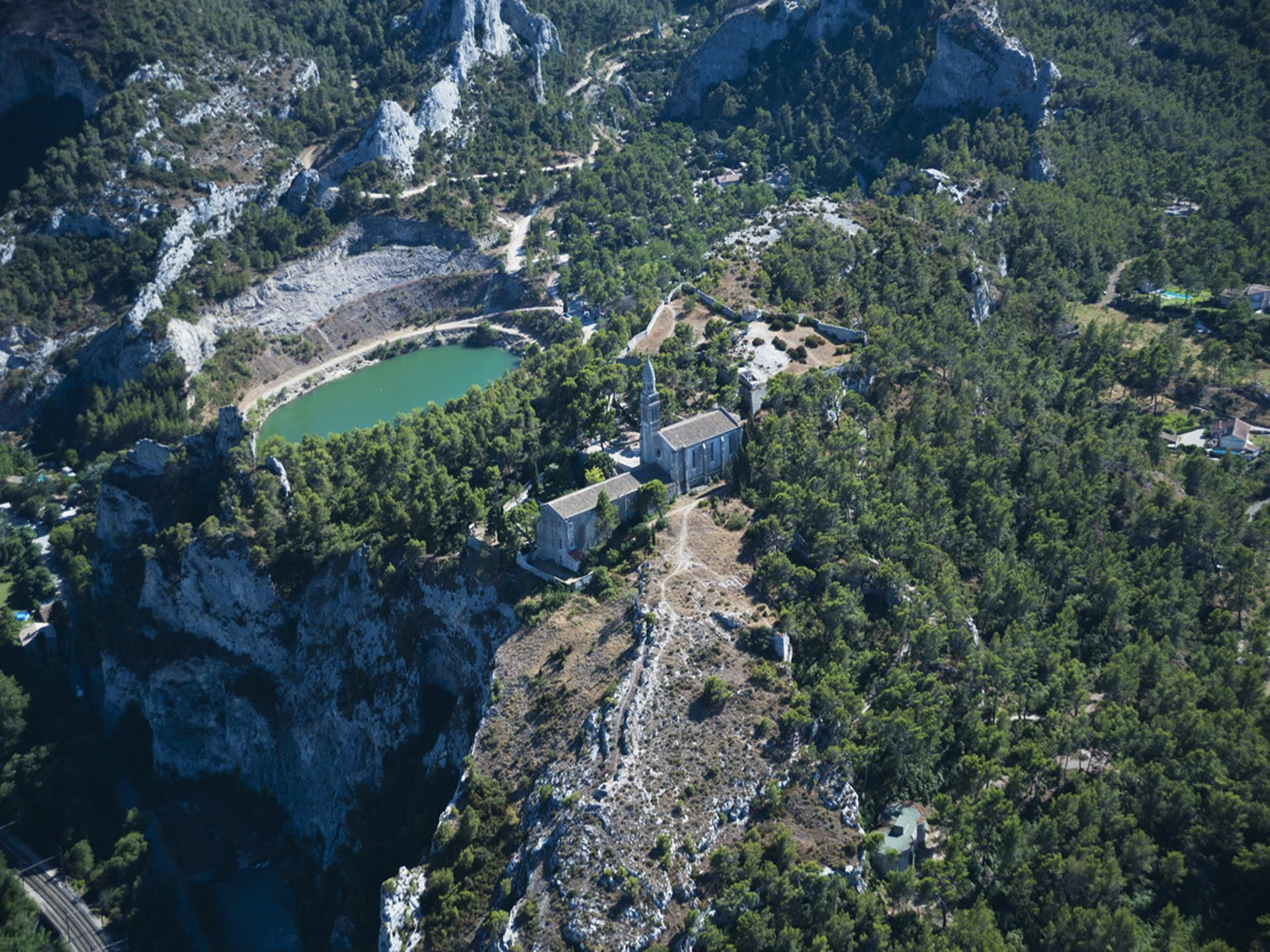
1- From the Urgonia museum, follow the blue markers opposite the car park of the bullring, on the track of Moulin à Vent up to the barrier DFCI which you cross Cross the pine forest to go to the right on the path towards the chapel Saint-Gervais built in the 15th century. 2- Then, reach the small quarry where fossiliferous blocks of urgonian limestone are deposited. 3- Go up to the viewpoint which overlooks the Montplaisant quarry. Observe the panoramic view of the calcium carbonate quarry, its working areas and its rehabilitated sectors with the remodelled and vegetated working faces Join and walk along an old gaudre, a rainwater drainage ditch, bordered by a dry stone wall which maintained the earth on the hillside and walk along it until you reach the "bancaou", a Provençal term for a bank of cultivated land. 4- Find the intersection with the road of the Windmill and turn to the right, in the direction of Notre-Dame de Beauregard, the road of Gaudre up to the cemetery of La Pinède. The chapel of Notre-Dame de Beauregard was built in 1878 and the monastery between 1638 and 1660. 5- Go up to the road of Notre-Dame de Beauregard Cross the fault, then look at the rocky ridges and peaks above Lavau lake, built in the former quarry of the Lavau valley, and on your left the superimposed strata of flint limestone, calcarenite and coral limestone On the esplanade of Beauregard, pass under the porch on your left to reach the orientation table which is in the old fort built in 1592. To reach the historical heart of the village, go back under the porch and take the "chemin des Oratoires" to the Reservoirs. Go down the path of the Château du Duc de Guise which overlooks the ditch of the Durance and the Luberon massif. This rocky spur was fortified in the last days of the Roman Empire. Demolished then rebuilt, it is in the XIIth century a famous military fortress, in charge of watching the valley of the Durance. It allowed the levying of a toll on travellers who crossed the river and on those who went along its left bank Once you reach the medieval site of Savoie, the former village of Orgon, go to the castle's lookout point and then pass in front of the medieval gate of Hortet before reaching the Place de la Liberté On the site of the Savoy, the old village existed. It was gradually deserted in favor of the current village. Only the imposing ruins of the medieval fort remain, from which you can admire the highest point of view over the Durance valley. It is the only remaining gate of the first enclosure built in the 12th century around the first village which stood at the foot of the castle. It is at this gate that the roads to Avignon and Saint Rémy ended. 6- Take time to appreciate the village : renaissance facade rue Georges Coste, porte de la Durance rue de la Fontaine, before going to the porte Sainte-Anne by the rue Jules Robert. 7- Cross the gate and go back to the road of Aires by the staircase on your left. Back to the starting point, discover in the Urgonia museum the heritage of the territory through the exhibition of geology, paleontology, archaeology and ornithology presented in the old prison dating from the 17th century.
Copyrights DR
A proximité:
Datatourism data updated on: 2024-05-24 14:41:43.213