Copyrights DR
France > Provence-Alpes-Côte d'Azur > Bouches-du-Rhône > 13550 > Noves > Office de tourisme
A 12km bike ride to visit the village center of Noves, and its heritage scattered through the Provencal countryside: ride through forest and orchards, to see mas, crosses, chapels...
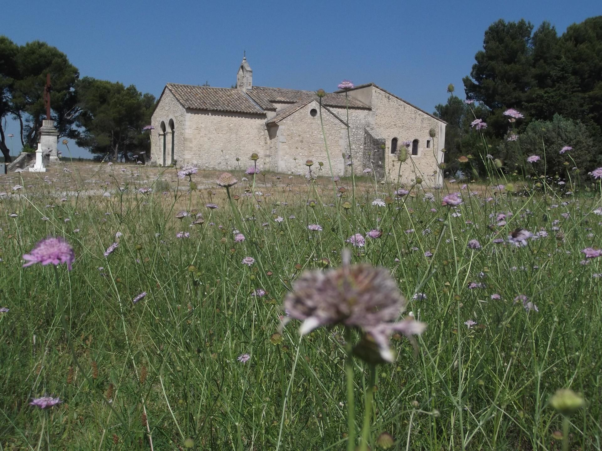
This route will take you on a discovery of Noves on the traces of its natural and historical heritage. From church to chapel, from hill to viewpoint, you will walk through the streets of the town, the paths of the small forest of Rougadou and the Petite Crau on the trail of oratories, crosses, flora and fountains that marked the highlights and symbols of the town's history. From the Tourist Office, head north on Boulevard République. At the roundabout, take the third exit, rue 1ère Armée for 130m, then turn right onto Rue Jean Moulin and the second street on the left: rue Bournissac On the Place Lagnel, turn right twice to reach the Rue Marcat and admire the Saint-Baudille church. This 15th century Romanesque church faces east, in keeping with the symbolism of Western builders. You can admire the dome, testimony of the episcopal character of the building, the apse decorated with Corinthian columns or the high altar. During its restoration, the bell tower was equipped with a carillon with five bells animated by a dozen melodies composed by an artist native of the village: Emmanuel Lautier. Pass under the Porte d'Aurose (or Chateaurenard) which surrounds the ramparts. The Porte d'Aurose, or the Porte de bise, is so named because it is where the north wind blows in. It was built during the third construction campaign of the ramparts in the 14th century (campaign aiming at including in the enclosure the new districts of Marcat and Malbourguet). Turn right and at the roundabout go straight ahead to find the street Agricol Viala on 200m. and the oratory Notre-Dame are located on this part of the route. The Notre-Dame oratory, votive, was erected against the plague of 1721, its purpose is to protect the village against epidemics. Then turn left towards Notre-Dame du Puech. The Way of the Cross and the chapel of Pieu are remarkable here. Take the climb to the right for 100m The chapel built on the Puech (Celtic word for hill which became Pieu in Provençal) is a key element in the history of the village. It was here that the Cavares settled the first settlement of Noves 600 years before Christ. The nave of the chapel was built in 1631 at the end of a plague epidemic and dedicated to Our Lady of Pity. In 1721, during a final plague epidemic, the consuls signed the "Vow of the Plague", a perpetual vow of procession, asking for the end of the epidemic which stopped shortly afterwards. Since 1721, the novices go on pilgrimage to the chapel every first Monday of September In the middle of the 19th century, a Way of the Cross was installed on the communal path leading up to the chapel, consisting of 14 stations. The chapel remains an integral part of the image of Noves, also serving as a magnificent natural setting for the recent Théâtre de Verdure. Behind the chapel continue for 450m to the roundabout, here you can see the oratory of Saint-Eloi. Go straight on for 200m along the Chemin de la Fabrique. At the intersection, turn left onto Derrière l'Eglise for 350m, then follow the Jeu de Mail path for 450m. After the bridge, turn left onto the Chemin du Pont des Dindes for 200m, then right onto the esplanade of the château. At the intersection, turn right twice to find the road to Eyragues for 500m. After the bridge, turn right onto the montée de la Tuilerie for 200m until you reach an intersection where you turn right and continue straight ahead until you reach the orientation table. You can admire the panorama from this point of view and discover the plan of the old castle. Turn around and at the second intersection, take the climb up the Rougadou hill for 400m. This is where the botanical path starts, which you can take to discover the flora of Rougadou. At the top of the hill, follow the Chemin des Crêtes for 1.5km, then at the crossroads take the second left onto the Chemin des Abeies for 600m Rougadou is a very small massif (254 ha), isolated in the middle of very little wooded areas. It is made up of several hills oriented globally in a North/South direction, with a low average altitude, but with relatively steep reliefs. Forming a group of wooded hills, the Rougadou massif has a very high afforestation rate, these stands being mainly composed of pine forests accompanied by holm oak. At the next intersection, continue on the route d'Eyragues for 250m and then turn left onto the Chicard de Pouvarel road for 550m. You are now in Notre-Dame-de-Vacquières. The site of Notre-Dame-de-Vacquières consists of a hermitage, a chapel and a spring. The fountain of Vacquières has always attracted the sick. Since pagan times, springs or fountains have had magical and beneficial virtues. This one is said to have beneficial properties in the fight against infertility. The name of Notre-Dame de Vacquières comes from the fact that a cow stopped at each passage it made while ploughing, and scraped the ground. The farmer was intrigued and dug at this spot and discovered the spring. To the right take the dirt track for 750m, cross the road and follow the Chemin du Grès for 250m until the intersection with the Villargelle cross. Turn left, cross the brook le Grand Anguillon. Take the second path on the left. Follow the Petit Anguillon for 400m, turn left. Take the first path on the left, and then the first path on the right You arrive at the D30, turn right. After 400m turn left at the crossroads of Mas de la Croix and continue for 250m. Turn left onto the Chemin de l'Eau for 1.4 km until you reach Place J. Jaurès, where you will find the Cross of the Porte d'Agel, a wrought iron cross dating from the 18th century.
Copyrights DR
A proximité:
Datatourism data updated on: 2024-04-17 05:08:12.602