France > Provence-Alpes-Côte d'Azur > Bouches-du-Rhône > 13550 > Noves > Village et plaine de la Durance
Hiking: Noves along the water.
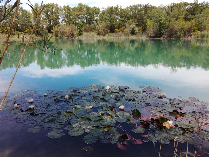
This route, mostly in the nature, will make you discover the Malautière, the banks of the Durance and the Anguillon before coming back to the "civilization" by discovering a part of the village. From the Tourist Information Office, head north. At the roundabout with the obelisk, turn right onto Avenue du 19 Mars 1962. Leave two streets on the left and take the 3rd one, Chemin du Moulin des Filles, towards the arena and the boulodrome. Cross the parking lot. 1. At the end, leave the crèche on the left and the boulodrome and the arenas on the right to go towards the old railroad through a cypress hedge. Cross it to reach the chemin de la Malautière and continue on the left towards the Route de Bonpas. At the road, take a slight right then after the bridge, cross the road and enter the meadow by passing between the 2 pillars. 2. At the end of the meadow follow the path along the Canal de la Malautière in the direction of the current, under the trees until you reach a green bridge. There, turn right towards the bed of the Durance. Follow it for about fifty meters then turn right. A little further, on a kind of clearing with 2 pines, take on the left. Follow the paths, always taking to the right to arrive at the soccer stadium. 3. Arrived at the stadium, under the poplars, take on the left until the wall with a water point (tap against a wall) in direction of the deviation. Then take the path on the left to go back on your steps, which avoids going along the highway and allows you to stay in the nature. At the end of the meadow, turn right into the small path. At the end, turn left to reach the lake of Iscles. 4. When you arrive at the lake, go around it in an anti-clockwise direction. At the end of the lake, turn right and then left on a very wide track that passes under a power line, cross a shaded area that brings you to the river crossing and a gate. Continue straight ahead to reach a paved area. Leave the path of the Prise d'Eau on your left and join the D28 called Route de Châteaurenard. 5. Continue on the right towards Châteaurenard on the old railroad. Just before the road bridge, cross the D28 and take the Chemin du Moulin de la Roque. Do not pass between the pillars of the monumental gate but turn left just in front of it and continue on this path which leads you to a housing estate and the place called Fabrique: a large building and follow the asphalt road. Turn right onto the road behind the church and then onto the chemin du jeu de Mail, up to the Pont des dindes. 6. At the bridge, turn left into rue du pont des Dindes and rue du Portalet and turn right into the esplanade of the castle (traverse du portalet). Take the stairs down between the two viewpoints, opening the small gate to get to rue du château d'eau. 7. Turn right into rue Louis Vouland. After crossing the Place Belle Laure, and once past the Porte d'Agel, turn left, towards the town hall on the Place Jean Jaurès. (D/A)
A proximité:
Datatourism data updated on: 2024-05-24 14:41:43.106